A single hailstorm across Dallas-Fort Worth can generate 200,000 property claims in 48 hours. Adjusters who once climbed every roof now assess most of that damage from a laptop. Storm damage technology has changed how fast homeowners and contractors move from wreckage to repair.
This post breaks down the specific tools reshaping damage assessment in 2026. You will learn which methods produce faster, more accurate results and how to spot restoration companies that use them.
What Storm Damage Technology Means in 2026
Storm damage technology is the set of hardware and software tools that measure, document, and estimate property damage after severe weather. It replaces slow manual walkthroughs with aerial imaging, sensors, and machine learning.
The shift matters because speed determines recovery. A faster, more efficient assessment means quicker insurance payouts and earlier repair starts.
In 2026, three advances stand out from prior years:
- AI hail-strike detection that flags individual roof impacts automatically
- Autonomous drone flights that scan a full roof in under six minutes
- Instant estimate generation tied to live regional material pricing
Drones and Aerial Imaging Cut Inspection Time
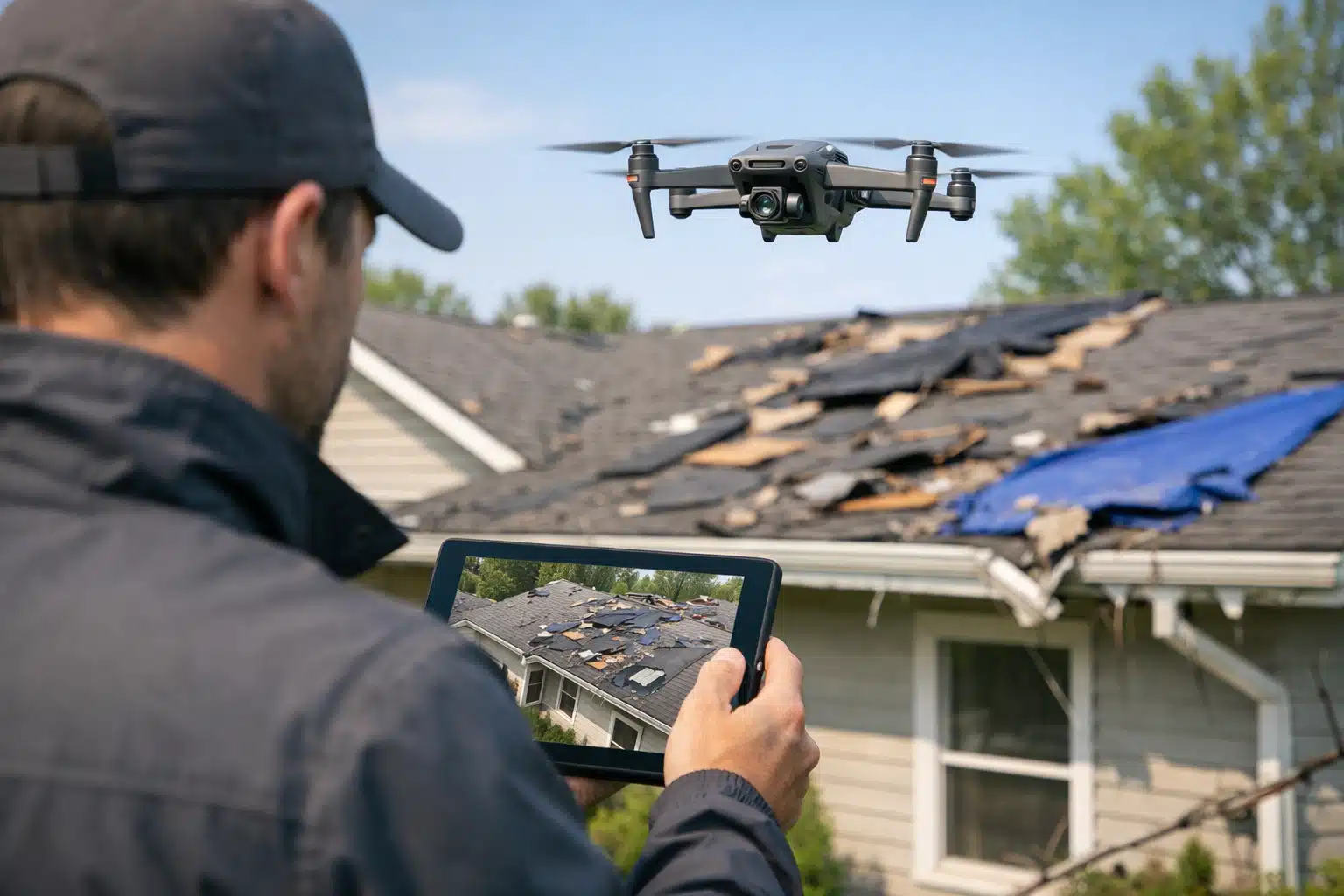
Drones are the biggest change in field assessment. A pilot flies a grid pattern over a roof and captures 150 to 300 high-resolution photos in minutes. No ladder, no fall risk, no half-day on-site.
How a Drone Assessment Runs
- The operator sets a flight boundary around the property on a tablet.
- The drone flies an automated grid at a fixed altitude.
- Cameras capture overlapping images for 3D reconstruction.
- Software stitches photos into a measured roof model.
- The model produces slope, pitch, and square footage figures.
A steep two-story roof once took an adjuster 45 minutes to measure by hand. A drone finishes the same job in six minutes with tighter accuracy.
Thermal Cameras Find Hidden Water
Thermal drones detect moisture behind walls and under decking. Wet insulation reads colder than dry material on an infrared feed. Crews mark those cold spots before tearing out drywall.
This matters after wind-driven rain, when water tracks far from the entry point. A leak at a ridge cap can soak insulation two rooms away.
AI Damage Detection Speeds Up Analysis
AI now reviews drone and phone photos to flag damage a human might miss. Trained models spot hail bruising, cracked shingles, and lifted flashing. The system tags each hit with a location and severity score.
One roofing contractor in Oklahoma reported that AI review cut per-claim analysis from 30 minutes to under five. The model marked 40 hail strikes on a single slope that manual review had undercounted.
Where AI Still Needs a Human
AI is fast but not final. Software confuses shadows, moss, and old repairs with fresh storm damage. A trained estimator reviews flagged areas before the report goes out.
Ask any provider how they verify AI results. A good answer includes a human quality check on every claim.
Satellite and Aerial Data for Wide-Area Events
Satellite imagery covers entire storm paths within hours. After a tornado, providers pull before-and-after images to prioritize which neighborhoods need crews first. This scale is impossible with ground inspection alone.
High-resolution aerial fleets fly over disaster zones on contract with insurers. They capture whole subdivisions at four-inch resolution. An adjuster can measure a roof from that image without a site visit.
- Satellite data works best for triage and routing crews
- Fixed-wing aerial imagery works best for detailed roof measurement
- Drone data works best for close-up damage confirmation
Mobile Apps and Cloud Reports Keep Everyone Aligned
Field apps put the full assessment on a phone. A crew lead photographs damage, dictates notes, and uploads everything to a shared cloud file. The homeowner, adjuster, and contractor see the same report in real time.
This removes the lag between inspection and estimate. In older workflows, a report sat on a desk for days before anyone acted. Cloud documentation shrinks that gap to hours.
What Good Documentation Includes
- Time-stamped, geotagged photos of each damaged area
- Measured roof diagrams with slope and area figures
- Moisture readings from thermal or probe tools
- Line-item estimates matched to current material costs
How to Choose a Provider That Uses Storm Damage Technology
Tech-forward providers finish faster and dispute fewer claims. When you search on Restoration Locator, look past general promises and ask about tools.
Use these steps to screen candidates:
- Filter listings by location to find crews near the storm zone.
- Check reviews for mentions of fast inspections or drone work.
- Ask each provider if they use drone imaging and AI damage detection.
- Request a sample assessment report to judge detail and clarity.
- Confirm they pair AI results with human verification.
A provider who scans your roof with a drone and sends a measured report the same day is worth the call. One who wants to schedule a manual climb next week is not matching the standard for efficient assessment.
Questions Worth Asking Directly
- How long from inspection to written estimate?
- Do you provide geotagged photo documentation for my insurer?
- Can you detect hidden moisture, or only visible damage?
- Who reviews the AI output before I get the report?
The Payoff for Homeowners and Contractors
Faster assessment shortens the whole recovery timeline. A drone flight plus AI review can turn a week-long claim into a same-day file. That speed matters most when a tarp is the only thing between your attic and the next storm.
Accurate data also reduces disputes. When photos, measurements, and moisture readings back every line item, insurers push back less. Homeowners get paid the correct amount without months of appeals.
Conclusion
Storm damage technology in 2026 pairs drones, AI, and cloud reporting to make assessment faster and more accurate than manual methods ever allowed. Homeowners who pick tech-forward providers recover sooner and fight fewer claim battles. Screen your candidates by asking about drone imaging, AI detection, and human verification.
Ready to find a crew that uses modern assessment tools? Browse Disaster Cleanup & Restoration listings now at Restoration Locator.